Fort Knox · Kentucky · Eastern LCNHT
Fort Knox
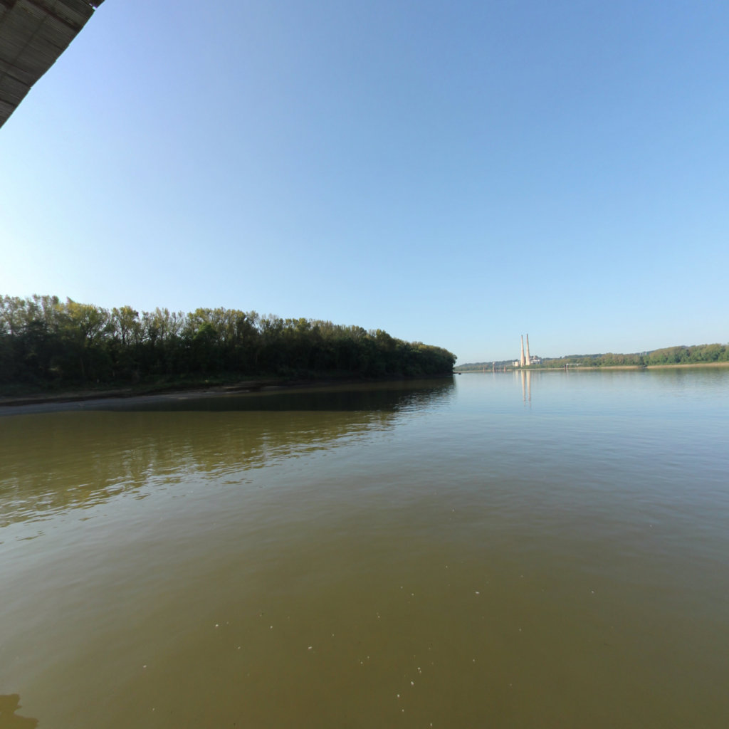
The Ohio River, where the Corps of Discovery began.
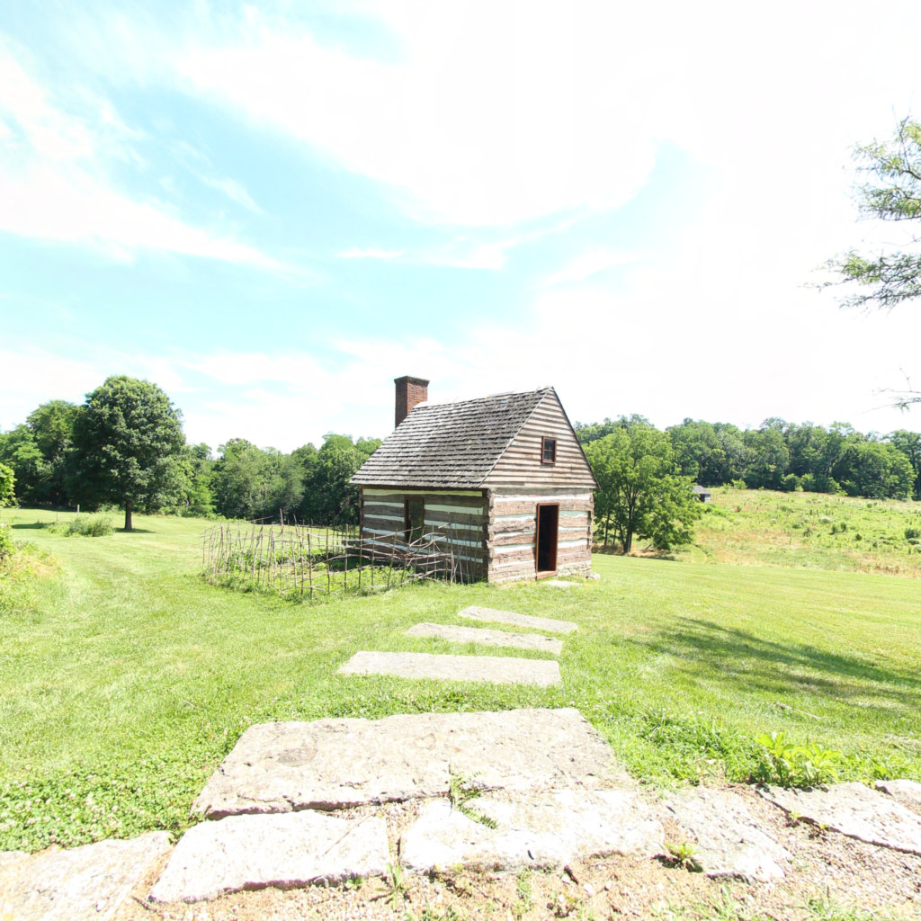
Locust Grove · George Rogers Clark home site · Louisville KY
Corridor narrative
Why protect this corridor.
Fort Knox sits on the eastern anchor of the Lewis & Clark National Historic Trail. The Ohio River corridor between West Point and Brandenburg, and the Falls of the Ohio just upstream at Louisville, was the staging ground for the Corps of Discovery's 1803 launch, where Meriwether Lewis met William Clark and the expedition truly began.
Today the same reaches carry a chain of public-access paddling, hiking, and interpretive sites: Otter Creek and Fort Duffield on the south bank, the Falls of the Ohio State Park and George Rogers Clark Home Site upstream, plus the broader Bernheim Forest network. The corridor is well-managed and almost entirely publicly accessible, with Salt River's installation-interior segment the only closure of note.
Fort Knox already runs a REPI program; this corridor is where its buffer and the public's recreation overlap. Keeping the Ohio River reaches and the trail network that links them to the installation's buffer lands open — through easements with willing landowners — protects the mission and the public access in one move. Continuous 360° imagery documents that ground for REPI reporting, NPS interpretation, and the protection case itself.
Lewis & Clark connection
Directly on the LCNHT Ohio River corridor (2019 expansion). Anchored by the Falls of the Ohio expedition launch area ~35 mi NE.
Directly on the LCNHT Ohio River corridor (added by the 2019 expansion). The Falls of the Ohio expedition launch area lies ~35 miles northeast of the installation, with the George Rogers Clark Home Site marking the formal start of the journey.
Strongest eastern LCNHT tie-in. Salt River segment INSIDE the installation is closed to public except Memorial Day — plan capture on West Point-downstream and upper Salt reaches.
See the ground
What's at stake, from the water: Locust Grove, Louisville KY.
Existing Terrain360 imagery from a nearby reach — a preview of the public-access value that buffer protection along the Fort Knox corridor would keep open.
The documentation layer
The record that backs the protection case.
Protecting the corridor is the goal; this is the documentation that supports it — baseline conditions and public-access value the partnership can reuse for REPI reporting, grant applications, and outreach.
Geo-referenced baseline dataset
Equirectangular panoramas + GPS tracks delivered to the installation INRMP team and the NPS Trail Office — documenting baseline conditions for REPI reporting, ESA Section 7, easement monitoring, and outreach.
Hosted 360° portal
Web-based interactive map showing pan-and-explore imagery of both riverbanks and every mapped trail. Mobile + desktop. Embeddable in any partner site.
Printable corridor maps
Asset index keyed to the imagery - suitable for visitor information, grant deliverable documentation, and partner co-branding.
L&C interpretive layer (optional)
Waypoint overlay tying the corridor to journal entries and historic sites - Tower Rock, Gates of the Mountains, the Falls portage, the Pacific arrival.
Asset inventory
What the corridor protects.
Each row is a recreation asset inside the buffer corridor — the public access and habitat a REPI/RARI easement would keep open.
| Recreation asset | Type | Miles | LCNHT | Access |
|---|---|---|---|---|
| Ohio River — West Point to Brandenburg reach Adjacent | River | 28 | Direct | Public |
| Ohio River — Louisville / Falls of the Ohio reach ~35 mi NE | River | 18 | Direct | Public |
| Salt River — West Point (mouth) reach Adjacent | River | 7 | Near | Public (interior segment closed) |
| Floyds Fork (Louisville paddling loop) ~35 mi NE | River | 12 | Near | Public |
| Otter Creek Outdoor Recreation Area trails Adjacent | Trail | 15 | Near | Public |
| Bernheim Arboretum & Research Forest trails ~28 mi NE | Trail | 40 | None | Public (fee) |
| Fort Duffield trails (Salt/Ohio confluence) Adjacent | Trail | 5 | Near | Public |
| West Point Ramp (Salt River access) Adjacent | Access | - | Near | Public |
| Falls of the Ohio State Park & Interpretive Center ~38 mi NE | Access | - | Direct | Public (fee) |
| George Rogers Clark Home Site (expedition launch) ~38 mi NE | Access | - | Direct | Public |
| Brandenburg Riverfront / boat access ~15 mi W | Access | - | Direct | Public |
Corridor map
Satellite view of the corridor footprint with the installation, its REPI buffer, and the recreation assets that protection keeps open.
The corridor up close
What these lands look like today.
Paddle the Ohio
Existing Terrain360 platform for the Ohio River, directly applicable to the Fort Knox corridor.
Open ↗
Ohio River (interactive map)
Live tour of the Ohio River corridor in and around Louisville.
Open ↗
Paddle the Kentucky
Companion Terrain360 platform for Kentucky paddling corridors.
Open ↗