Maps & data
The corridor, on paper and in data.
Everything here comes from one dataset: the National Park Service DOD Lands analysis for the Lewis & Clark National Historic Trail. Print the reference sheets, explore the interactive map, or download the GIS data itself.
Computed from the NPS LECL DOD Lands dataset (geodesic areas, WGS84). Acreage covers all DoD lands inside the corridor study area, including the Eastern Legacy segments.
Reference maps
The NPS DOD Lands map series.
Produced by the NPS Lewis & Clark NHT resources team, these sheets map Department of Defense lands and candidate installations along the trail’s Eastern Legacy segments, Pittsburgh to St. Louis. They are working drafts under review; final versions will replace them here as they’re issued.
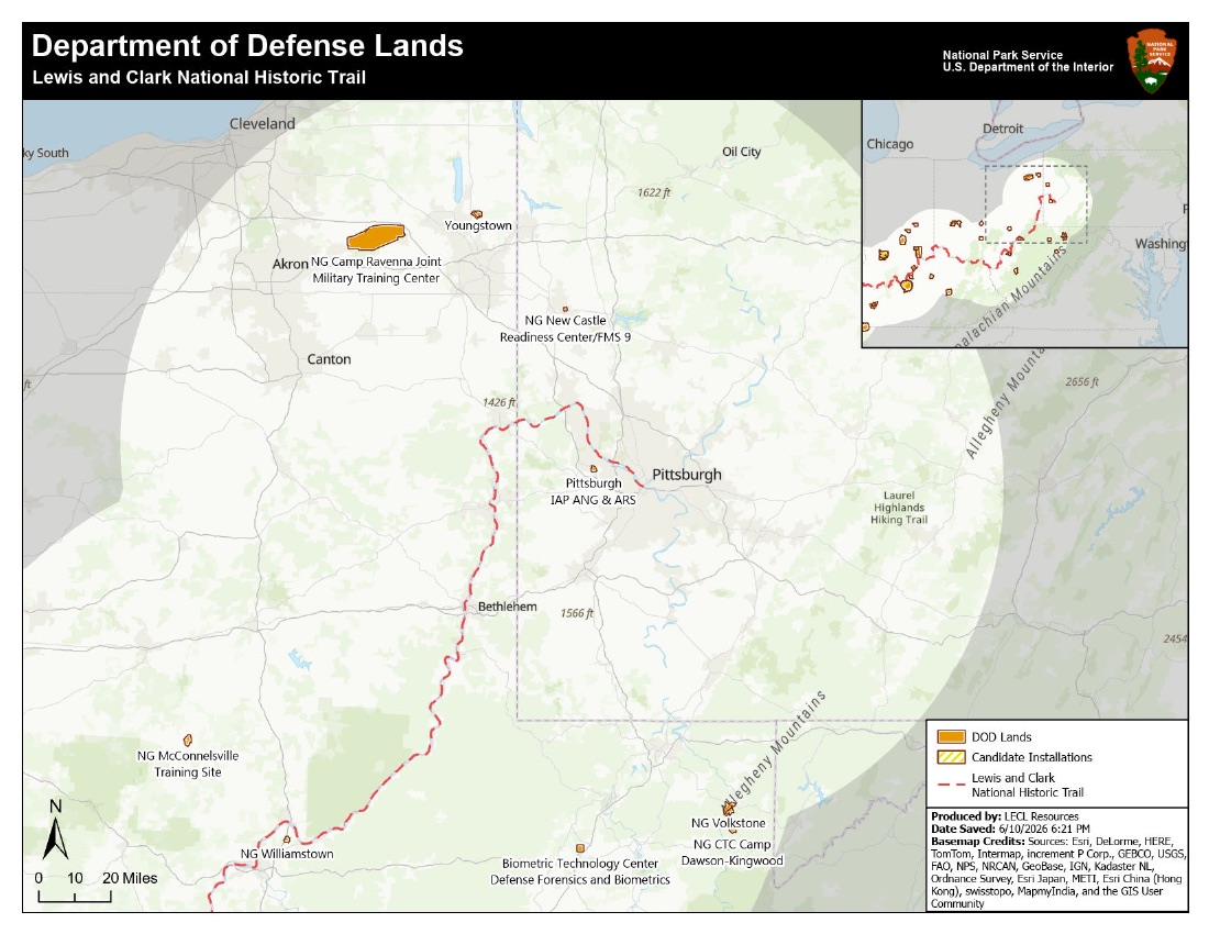
1. Pittsburgh & the Upper Ohio
PDF ↓Pennsylvania · Ohio · West Virginia
The eastern end of the trail. Camp Ravenna, the Pittsburgh ANG & ARS, Camp Dawson-Kingwood, and the Guard sites along the upper Ohio.
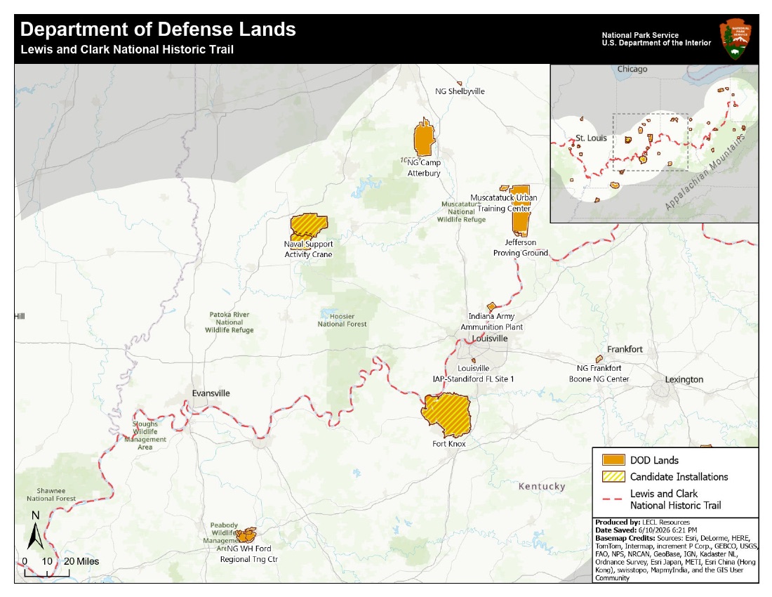
2. Falls of the Ohio
PDF ↓Indiana · Kentucky
Louisville and the Falls region, where the Corps of Discovery formed. Fort Knox, NSA Crane, Camp Atterbury, Muscatatuck, and Jefferson Proving Ground. Fort Knox and Crane carry the candidate-installation hatch.
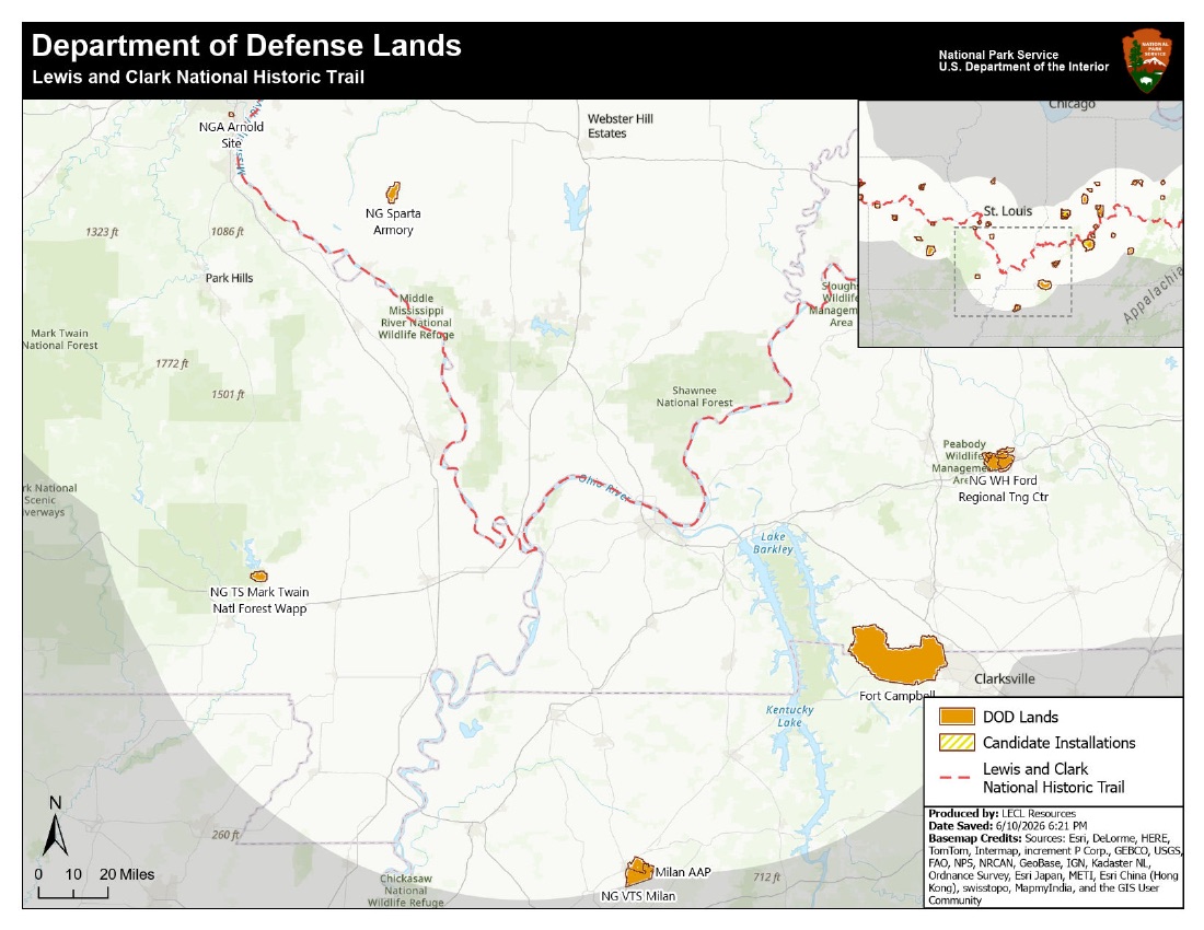
3. Ohio River Confluence
PDF ↓Illinois · Missouri · Kentucky · Tennessee
The Ohio meets the Mississippi. Fort Campbell anchors the south end of the sheet; Shawnee National Forest and three national wildlife refuges share the corridor.
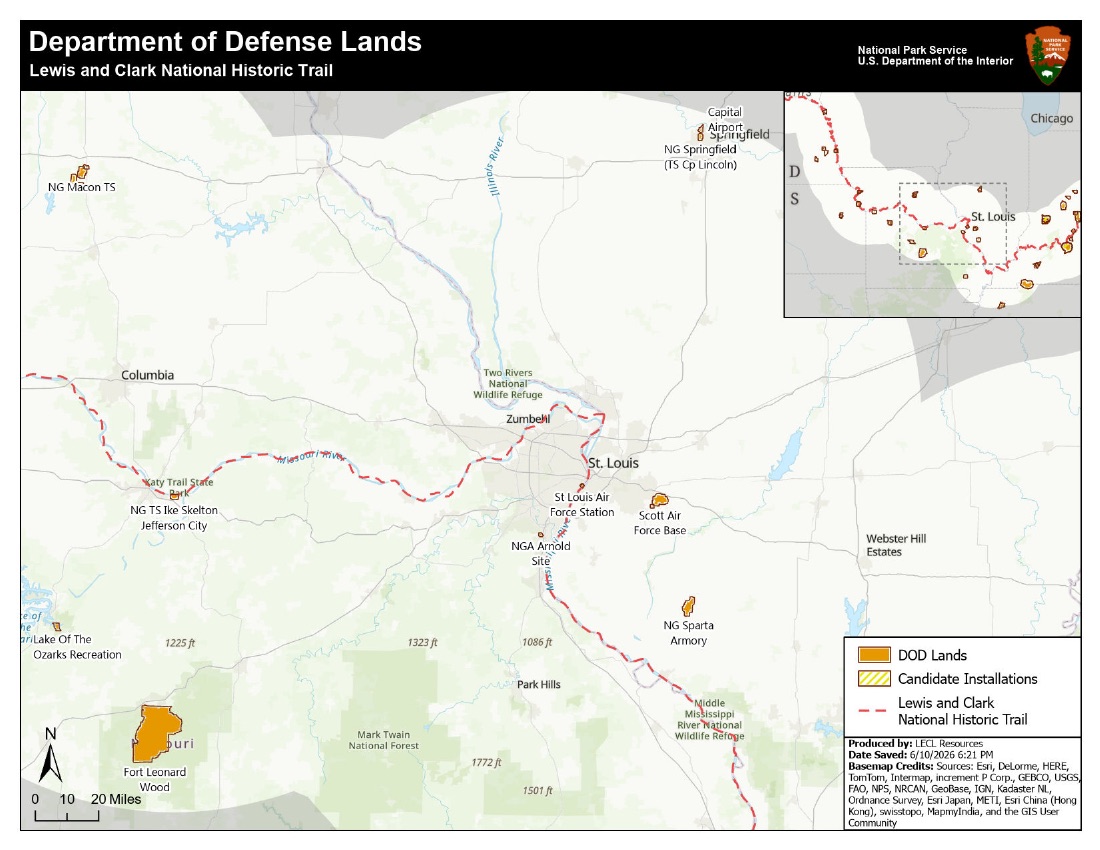
4. St. Louis & the Lower Missouri
PDF ↓Missouri · Illinois
The expedition’s departure point. Scott AFB, Fort Leonard Wood, the NGA Arnold Site, and the Guard posts around the confluence where the journey began.
Draft series, June 2026. Cartography: NPS Lewis & Clark National Historic Trail, LECL Resources. Basemap credits as printed on each sheet.
Eastern Legacy
The trail didn’t always start in St. Louis.
In 2019, Congress extended the Lewis & Clark National Historic Trail roughly 1,200 miles east, from Wood River, Illinois to Pittsburgh, tracing the route Lewis traveled down the Ohio to meet Clark and form the Corps of Discovery. These Eastern Legacy segments are the newest part of the trail and the least documented.
The DOD Lands series above is the first systematic look at the defense footprint along them: Fort Campbell, Fort Leonard Wood, Camp Atterbury, Jefferson Proving Ground, and dozens of Guard sites share the corridor, and two installations, Fort Knox and NSA Crane, already carry candidate status in the analysis. The same conservation model documented across the twelve western corridors applies here, and these sheets are where that next chapter starts.
The interactive corridor map.
The same dataset, live: installation footprints, the corridor study area, and the trail route, with a marker for each of the twelve program corridors.
Open data
Download the GIS data.
The layers behind the maps, extracted from the NPS DOD Lands ArcGIS package and served as GeoJSON (WGS84). Free to reuse with attribution to the NPS Lewis & Clark NHT.
- dod_installations.geojson
128 Department of Defense land polygons inside the corridor study area: 74 named installations and sites, from Fort Knox to single-armory Guard posts.
- dod_buffer.geojson
The corridor study area: a roughly 100-mile band along the trail, about 543,000 square miles end to end.
- lc_route.geojson
The Lewis & Clark National Historic Trail route in 62 segments, including the Eastern Legacy extension.